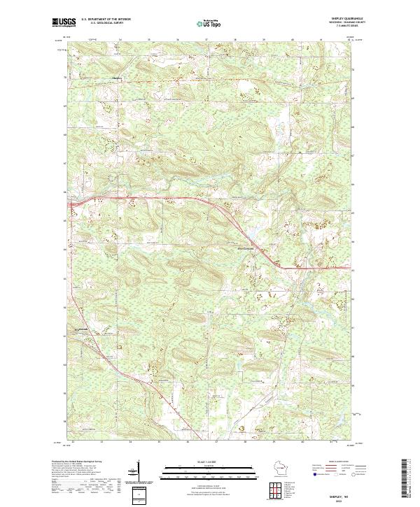
2022 Map of Shepley
USGS Topo · Published 2022About this map
The Middle Branch Embarrass River and its numerous tributaries, including Dent Cr and Strassburg Cr, dominate this section of Shawano County. The landscape is defined by the winding course of the Mountain-Bay State Trl, which follows a former rail corridor across the northern townships. Small unincorporated settlements like Shepley and Whitcomb serve as local anchors, connected by a network of townline roads such as Wittbern Townline Rd and Wittmar Townline Rd.
Find a feature on this map
61 named features on this map. Tap any name to fly to it.
Don’t see what you’re looking for? This feature index may not catch every label — zoom into the map to look around manually.
Map Details
Editions of this 2022 Shepley Map
This is the sole edition of this map. No revisions or reprints were ever made.
Other maps of this area

1954 · Wittenberg
USGS Topo · 1:48,000

1954 · Gresham
USGS Topo · 1:48,000

1955 · Clintonville
USGS Topo · 1:48,000

1955 · Tigerton
USGS Topo · 1:48,000

1955 · Green Bay
USGS Topo · 1:250,000

1964 · Wittenberg
USGS Topo · 1:62,500

1964 · Gresham
USGS Topo · 1:62,500
1970 · Tigerton NW
USGS Topo · 1:24,000
1970 · Marion
USGS Topo · 1:24,000
1970 · Tigerton
USGS Topo · 1:24,000