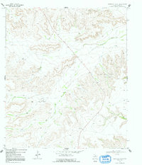
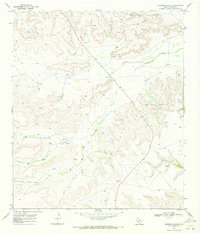
1969 Map of Sherbino Ranch
USGS Topo · Published 1992About this map
Sherbino Ranch and the surrounding high plains of Pecos County are defined by a landscape of resource extraction and isolated ranching operations in the late 1960s. The region's economy is clearly etched into the terrain, dominated by the White Baker Oil Field to the north and the Priest Beavers Oil Field toward the east. Numerous Drill Holes and Oil Wells pepper the ridges and draws, illustrating the intensity of petroleum exploration during this era.
Find a feature on this map
12 named features on this map. Tap any name to fly to it.
Don’t see what you’re looking for? This feature index may not catch every label — zoom into the map to look around manually.
Map Details
Editions of this 1969 Sherbino Ranch Map
2 editions found
Other maps of this area

1929 · Independence Draw Quadrangle
USGS Topo · 1:125,000

1954 · Fort Stockton
USGS Topo · 1:250,000

1958 · Fort Stockton
USGS Topo · 1:250,000
1969 · Smoky Mountain Ranch
USGS Topo · 1:24,000

1969 · Hackberry Draw NE
USGS Topo · 1:24,000
1969 · Hat-A Ranch
USGS Topo · 1:24,000

1969 · Indian Mesa
USGS Topo · 1:24,000
1969 · Indian Mesa SE
USGS Topo · 1:24,000

1969 · Bakersfield
USGS Topo · 1:24,000
1969 · Sherbino Ranch
USGS Topo · 1:24,000