
1968 Map of Sherbrooke
USGS Topo · Published 1970About this map
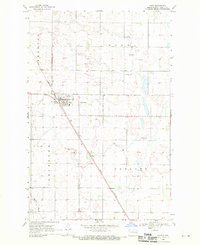
Sherbrooke stands as a focal point in this 1960s study of the North Dakota prairie, situated within the wider administrative divisions of Easton and Sherbrooke townships. The landscape is characterized by a high density of small water bodies and wetlands typical of the region, interspersed with a grid of section lines and field boundaries. Evidence of local infrastructure includes the Sherbrooke Cem and numerous Gravel Pits, indicating the essential extraction of materials for road building in this rural expanse. Bordering Golden Lake 34 to the north and reaching toward Hugo in the south, the map illustrates a highly organized agricultural layout where fine dashed red lines denote fence and field lines captured during 1964 aerial photography.
Find a feature on this map
8 named features on this map. Tap any name to fly to it.
Don’t see what you’re looking for? This feature index may not catch every label — zoom into the map to look around manually.
Map Details
Editions of this 1968 Sherbrooke Map
This is the sole edition of this map. No revisions or reprints were ever made.
Other maps of this area

1952 · Grand Forks
USGS Topo · 1:250,000

1956 · Grand Forks
USGS Topo · 1:250,000

1966 · Grand Forks
USGS Topo · 1:250,000

1966 · Hope SE
USGS Topo · 1:24,000

1967 · Blabon
USGS Topo · 1:24,000

1967 · Finley
USGS Topo · 1:24,000

1967 · Luverne SE
USGS Topo · 1:24,000

1968 · Hope NE
USGS Topo · 1:24,000
1968 · Hope
USGS Topo · 1:24,000
1970 · Northwood SE
USGS Topo · 1:24,000
Featured Places
- Sherbrooke Township, ND
- Easton Township, ND
- Golden Lake Township, ND
- Hugo Township, ND
- Melrose Township, ND