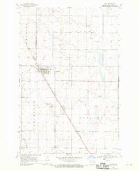
1968 Map of Hope
USGS Topo · Published 1970About this map
Hope serves as the central hub of this agricultural landscape in Steele County, where the street grid of the town sits at the intersection of local roads and the Great Northern railroad. The surrounding countryside is divided into the civil townships of Hugo, Carpenter, and Colgate, illustrating the systematic land division of the North Dakota plains. The rail line cuts a diagonal path through the terrain, passing just west of the town center and south toward the Maple River valley.
Find a feature on this map
11 named features on this map. Tap any name to fly to it.
Don’t see what you’re looking for? This feature index may not catch every label — zoom into the map to look around manually.
Map Details
Editions of this 1968 Hope Map
This is the sole edition of this map. No revisions or reprints were ever made.
Other maps of this area

1952 · Grand Forks
USGS Topo · 1:250,000

1956 · Grand Forks
USGS Topo · 1:250,000

1966 · Grand Forks
USGS Topo · 1:250,000

1966 · Hope SE
USGS Topo · 1:24,000

1967 · Blabon
USGS Topo · 1:24,000

1967 · Page
USGS Topo · 1:24,000
1967 · Pillsbury
USGS Topo · 1:24,000

1967 · Colgate
USGS Topo · 1:24,000

1967 · Luverne SE
USGS Topo · 1:24,000

1968 · Hope NE
USGS Topo · 1:24,000