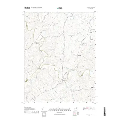
2019 Map of Sherburne
USGS Topo · Published 2019About this map
The Licking River carves a winding path through the borderlands of Nicholas, Fleming, and Bath Counties, defining the rural character of this Kentucky landscape. At the historic crossing of Sherburne, the Sherburne Bridge connects local travel across the water, while further north The Iron Bridge spans Fleming Creek. The area is marked by long-standing agricultural settlements such as Upper Blue Licks, Milltown, and Battle Run, which are situated among a complex network of ridges including Pecks Ridge. Small family and community burial grounds, such as Log Union Cem, Gilead Cem, and Porter Cem, are scattered across the uplands, offering significant touchpoints for genealogical research. The map illustrates a traditional Kentucky upland pattern where small communities like Hill Top and Olive Branch are linked by winding ridge-top roads and narrow creek valleys.
Find a feature on this map
92 named features on this map. Tap any name to fly to it.
Don’t see what you’re looking for? This feature index may not catch every label — zoom into the map to look around manually.
Map Details
Editions of this 2019 Sherburne Map
This is the sole edition of this map. No revisions or reprints were ever made.
Other maps of this area

1929 · Salt Lick
USGS Topo · 1:62,500

1934 · Salt Lick
USGS Topo · 1:62,500

1951 · Hillsboro
USGS Topo · 1:24,000

1951 · Flemingsburg
USGS Topo · 1:24,000

1952 · Cowan
USGS Topo · 1:24,000

1952 · Owingsville
USGS Topo · 1:24,000

1952 · Sharpsburg
USGS Topo · 1:24,000

1952 · Sherburne
USGS Topo · 1:24,000

1952 · Elizaville
USGS Topo · 1:24,000

1953 · Moorefield
USGS Topo · 1:24,000