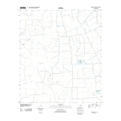
2010 Map of Sheridan NE
USGS Topo · Published 2010About this map
The Sheridan Gas Field defines the industrial footprint of this Colorado County landscape, where energy extraction meets an intricate network of coastal plain drainage. The terrain is defined by the diverging branches of East Sandy Creek, Middle Sandy Creek, and West Sandy Creek, which weave through a grid of rural county roads. Water management for local use is evident in significant man-made impoundments, including the Kallina Reservoir held by the Kallina Reservoir Dam and Engstrom Lake Number 1 to the southeast. These reservoirs, alongside Pinoak Creek and Bucksnag Creek, illustrate the importance of water security in this ranching and resource-rich region of Texas. A network of local routes like Cedar Brush Ranch Rd and Reeves-Bass Rd provide access to the dispersed agricultural holdings and gas infrastructure that characterize the area.
Find a feature on this map
28 named features on this map. Tap any name to fly to it.
Don’t see what you’re looking for? This feature index may not catch every label — zoom into the map to look around manually.
Map Details
Editions of this 2010 Sheridan NE Map
This is the sole edition of this map. No revisions or reprints were ever made.
Other maps of this area

1953 · Seguin
USGS Topo · 1:250,000

1956 · Glidden
USGS Topo · 1:62,500

1957 · Eagle Lake
USGS Topo · 1:62,500

1957 · Altair
USGS Topo · 1:24,000

1958 · Seguin
USGS Topo · 1:250,000

1959 · Garwood
USGS Topo · 1:24,000

1964 · Speaks
USGS Topo · 1:24,000

1965 · Sawmill Branch
USGS Topo · 1:24,000

1965 · Rock Island
USGS Topo · 1:24,000
1965 · Sheridan NE
USGS Topo · 1:24,000