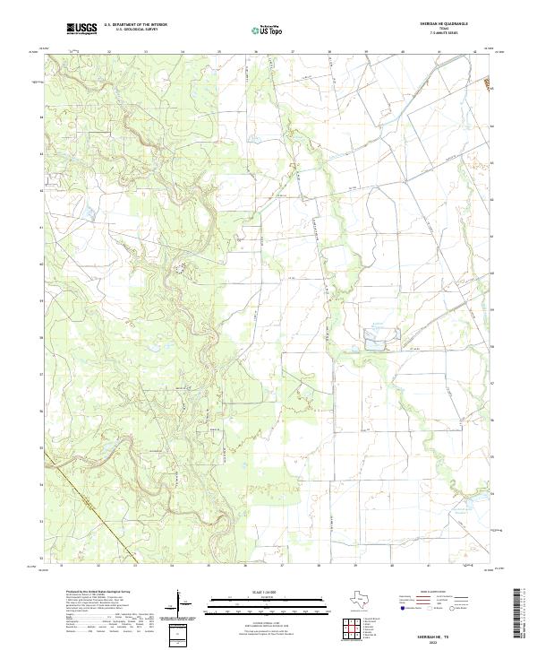
2022 Map of Sheridan NE
USGS Topo · Published 2022About this map
The convergence of Sandy Cr, Middle Sandy Cr, and East Sandy Creek creates a complex drainage network in this section of Colorado County. The landscape is defined by managed water systems and rural infrastructure, including Kallina Reservoir and the Leher Canal, which facilitate agricultural operations in the Texas coastal plain. Several local roads such as Reeves-Bass Rd and Ceder Post Ranch Rd provide access to dispersed homesteads and ranch lands, reflecting the long-standing land-use patterns of the region. The boundary with Lavaca Co is visible in the southwest, where the terrain slopes toward West Sandy Creek. This 2022 survey documents the modern layout of rural properties and water management features like Engstrom Lake Number 1, essential for understanding contemporary land ownership and hydrological changes.
Find a feature on this map
36 named features on this map. Tap any name to fly to it.
Don’t see what you’re looking for? This feature index may not catch every label — zoom into the map to look around manually.
Map Details
Editions of this 2022 Sheridan NE Map
This is the sole edition of this map. No revisions or reprints were ever made.
Other maps of this area

1953 · Seguin
USGS Topo · 1:250,000

1956 · Glidden
USGS Topo · 1:62,500

1957 · Eagle Lake
USGS Topo · 1:62,500

1957 · Altair
USGS Topo · 1:24,000

1958 · Seguin
USGS Topo · 1:250,000

1959 · Garwood
USGS Topo · 1:24,000

1964 · Speaks
USGS Topo · 1:24,000

1965 · Sawmill Branch
USGS Topo · 1:24,000

1965 · Rock Island
USGS Topo · 1:24,000
1965 · Sheridan NE
USGS Topo · 1:24,000