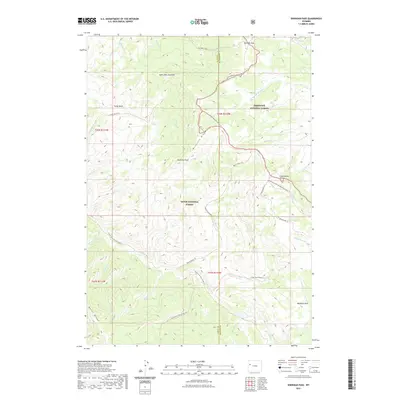
2021 Map of Sheridan Pass
USGS Topo · Published 2021About this map
Sheridan Pass serves as a critical geographic marker along the Continental Divide, where the waters of the Shoshone National Forest and Teton National Forest split toward the Atlantic and Pacific watersheds. This high-altitude landscape is defined by its complex network of seasonal drainage and pack trails, including the Continental Divide National Scenic Trail which winds across Buckskin Ridge. In the southeastern portion of the map, Washakie Park represents a significant high-mountain meadow system, while the Saint John Overlook provides a vantage point over the Purdy Basin. The absence of roads and the reliance on named paths like the Little Devil's Basin Trail and Sheridan Creek Trail highlight the wilderness character of the Wyoming terrain as documented in this 2021 survey.
Find a feature on this map
46 named features on this map. Tap any name to fly to it.
Don’t see what you’re looking for? This feature index may not catch every label — zoom into the map to look around manually.
Map Details
Editions of this 2021 Sheridan Pass Map
This is the sole edition of this map. No revisions or reprints were ever made.
Other maps of this area

1902 · Mt Leidy
USGS Topo · 1:125,000

1905 · Younts Peak
USGS Topo · 1:125,000

1907 · Younts Peak
USGS Topo · 1:125,000

1907 · Gros Ventre
USGS Topo · 1:125,000

1909 · Fremont Peak
USGS Topo · 1:125,000

1910 · Gros Ventre
USGS Topo · 1:125,000

1955 · Driggs
USGS Topo · 1:250,000

1955 · Thermopolis
USGS Topo · 1:250,000

1956 · Fish Lake
USGS Topo · 1:24,000

1956 · Kisinger Lakes
USGS Topo · 1:24,000