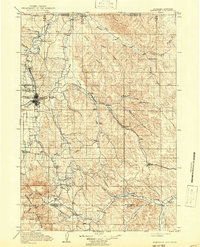
1911 Map of Sheridan
USGS Topo · Published 1941About this map
Sheridan serves as the focal point of this northern Wyoming landscape, established at the junction of Goose Creek and Little Goose Creek just before the turn of the century. The town's early expansion is tied closely to the Chicago Burlington and Quincy RR, which cuts a diagonal path through the territory, linking coal-mining settlements like Dietz and small railroad stops like Verona. To the west, the foothills rise toward the Bighorn Mountains and the boundary of the Bighorn National Forest, where the terrain transitions from agricultural river valleys to steep timberland.
Find a feature on this map
44 named features on this map. Tap any name to fly to it.
Don’t see what you’re looking for? This feature index may not catch every label — zoom into the map to look around manually.
Map Details
Editions of this 1911 Sheridan Map
2 editions found
Other maps of this area

1894 · Rosebud
USGS Topo · 1:125,000

1895 · Dayton
USGS Topo · 1:125,000

1899 · Cloud peak
USGS Topo · 1:125,000

1900 · Fort McKinney
USGS Topo · 1:125,000

1901 · Rosebud
USGS Topo · 1:125,000

1901 · Cloud Peak
USGS Topo · 1:125,000

1901 · Dayton
USGS Topo · 1:125,000

1903 · Fort McKinney
USGS Topo · 1:125,000

1909 · Sheridan
USGS Topo · 1:125,000

1911 · Sheridan
USGS Topo · 1:125,000