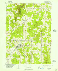
1954 Map of Sherman
USGS Topo · Published 1957About this map
The village of Sherman serves as the focal point of this southwestern Chautauqua County survey, where the valley of French Creek meets the Pennsylvania RR. The landscape is characterized by a mix of agricultural valley floors and rising hills preserved as State Reforestation Areas. Evidence of early community infrastructure is abundant, particularly in the village core which contains Central Ch and the Sherman School. Outlying hamlets like Summerdale and North Harmony mark historical crossroads, with the latter featuring its own North Harmony Ch. The map also documents rural cemetery locations like Porter Cem and specialized transportation nodes such as the RR Sta and a Sub Sta. The dense network of named family roads, including Bement Rd and Freeman Rd, illustrates the deeply rooted rural settlement patterns of the mid-1950s.
Find a feature on this map
48 named features on this map. Tap any name to fly to it.
Don’t see what you’re looking for? This feature index may not catch every label — zoom into the map to look around manually.
Map Details
Editions of this 1954 Sherman Map
3 editions found
Other maps of this area

1899 · Westfield
USGS Topo · 1:62,500

1900 · Dunkirk
USGS Topo · 1:62,500

1904 · Chautaqua
USGS Topo · 1:62,500

1905 · Clymer
USGS Topo · 1:62,500

1939 · Clymer
USGS Topo · 1:62,500

1941 · Chautauqua
USGS Topo · 1:62,500

1941 · Clymer
USGS Topo · 1:62,500

1943 · Dunkirk
USGS Topo · 1:62,500

1954 · Chautauqua
USGS Topo · 1:24,000

1954 · South Ripley
USGS Topo · 1:24,000