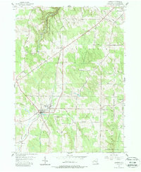
1954 Map of Sherman
USGS Topo · Published 1988About this map
Sherman serves as the primary hub of this western New York landscape, situated at the confluence of several local roads and the Pennsylvania railroad line. The village is well-defined by its Central Sch and a local Cem, reflecting the civic center of the township. Beyond the village, the terrain is shaped by the drainage of French Creek and Chautauqua Creek, with significant portions of the land dedicated to the State Reforestation Area, indicating a transition in land use toward managed timber and conservation by the mid-20th century.
Find a feature on this map
43 named features on this map. Tap any name to fly to it.
Don’t see what you’re looking for? This feature index may not catch every label — zoom into the map to look around manually.
Map Details
Editions of this 1954 Sherman Map
3 editions found
Other maps of this area

1899 · Westfield
USGS Topo · 1:62,500

1900 · Dunkirk
USGS Topo · 1:62,500

1904 · Chautaqua
USGS Topo · 1:62,500

1905 · Clymer
USGS Topo · 1:62,500

1939 · Clymer
USGS Topo · 1:62,500

1941 · Chautauqua
USGS Topo · 1:62,500

1941 · Clymer
USGS Topo · 1:62,500

1943 · Dunkirk
USGS Topo · 1:62,500

1954 · Chautauqua
USGS Topo · 1:24,000

1954 · South Ripley
USGS Topo · 1:24,000