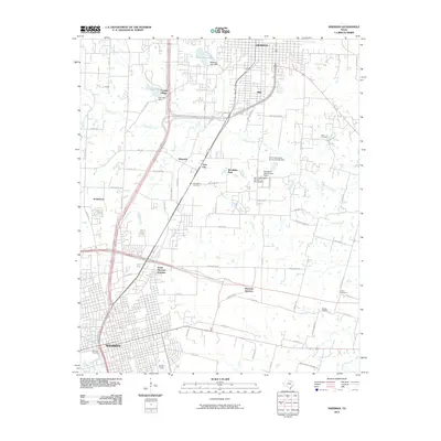
2010 Map of Sherman
USGS Topo · Published 2010About this map
The expanding corridor between Sherman and Denison highlights a landscape of mid-century infrastructure and residential growth. This area is characterized by a series of water management sites, including Waterloo Lake and Loy Lake, along with several soil conservation dams that moderate the flow of Iron Ore Creek. The transition from the established street grid of Sherman to suburban developments like Knollwood and Frontier Village illustrates the region's northward expansion. Genealogists will find significant value in the distribution of family and community burial grounds, such as West Hill Cemetery, Bethany Cemetery, and Odell Cemetery. The local transport network is anchored by critical rail and road hubs, most notably North Sherman Junction and the Sherman Municipal Airport, reflecting the area's role as a regional transit point.
Find a feature on this map
50 named features on this map. Tap any name to fly to it.
Don’t see what you’re looking for? This feature index may not catch every label — zoom into the map to look around manually.
Map Details
Editions of this 2010 Sherman Map
This is the sole edition of this map. No revisions or reprints were ever made.
Other maps of this area

1901 · Denison
USGS Topo · 1:125,000

1954 · Sherman
USGS Topo · 1:250,000

1957 · Denison Dam
USGS Topo · 1:24,000

1958 · Durant
USGS Topo · 1:62,500

1958 · Dorchester
USGS Topo · 1:24,000

1958 · Whitesright
USGS Topo · 1:62,500

1958 · Denison Dam
USGS Topo · 1:62,500

1958 · Sherman NW
USGS Topo · 1:24,000

1958 · Sherman
USGS Topo · 1:250,000

1958 · Sherman
USGS Topo · 1:62,500