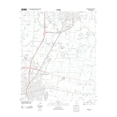
2013 Map of Sherman
USGS Topo · Published 2013About this map
Austin College serves as a central landmark in this 2013 landscape, where the urban grid of Sherman meets the growing residential and commercial corridors of north Texas. The topography is defined by the winding paths of Iron Ore Cr and Choctaw Cr, which bound the developed areas. Transportation infrastructure is prominent, featuring the convergence of major highways near North Sherman Junction and Sherman Junction. Historical layers are visible through several local burial grounds, including Woodlawn Cem and Bethany Cem, while recreational and community spaces like Waterloo Lake, Loy Lake, and Frontier Village highlight the area's development. Small settlements and specialized neighborhoods such as Knollwood, Ellsworth, and Twin City appear alongside the operational facilities of the Sherman Municipal Airport.
Find a feature on this map
222 named features on this map. Tap any name to fly to it.
Don’t see what you’re looking for? This feature index may not catch every label — zoom into the map to look around manually.
Map Details
Editions of this 2013 Sherman Map
This is the sole edition of this map. No revisions or reprints were ever made.
Other maps of this area

1901 · Denison
USGS Topo · 1:125,000

1954 · Sherman
USGS Topo · 1:250,000

1957 · Denison Dam
USGS Topo · 1:24,000

1958 · Durant
USGS Topo · 1:62,500

1958 · Dorchester
USGS Topo · 1:24,000

1958 · Whitesright
USGS Topo · 1:62,500

1958 · Denison Dam
USGS Topo · 1:62,500

1958 · Sherman NW
USGS Topo · 1:24,000

1958 · Sherman
USGS Topo · 1:250,000

1958 · Sherman
USGS Topo · 1:62,500