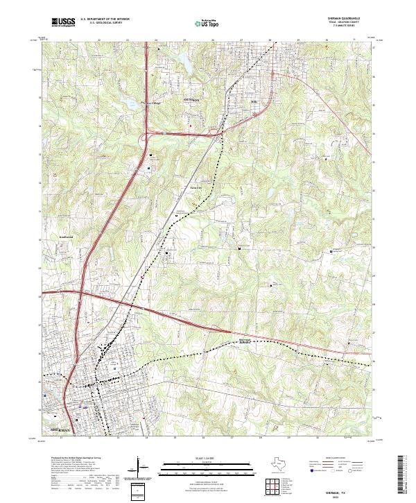
2022 Map of Sherman
USGS Topo · Published 2022About this map
Sherman and Denison anchor this Grayson County landscape, where the urban expansion of North Texas meets the traditional rural cemetery and creek systems of the Red River valley. The central corridor is dominated by the junction of US Hwy 75, US Hwy 82, and the BNSF Railway, illustrating the modern transportation infrastructure that sustains these growing cities. Historically significant sites such as Austin College and the Grayson County Courthouse mark the civic heart of Sherman, while outlying settlements like Knollwood, Frontier Village, and Twin City suggest the infilling of once-distinct communities.
Find a feature on this map
39 named features on this map. Tap any name to fly to it.
Don’t see what you’re looking for? This feature index may not catch every label — zoom into the map to look around manually.
Map Details
Editions of this 2022 Sherman Map
This is the sole edition of this map. No revisions or reprints were ever made.
Other maps of this area

1901 · Denison
USGS Topo · 1:125,000

1954 · Sherman
USGS Topo · 1:250,000

1957 · Denison Dam
USGS Topo · 1:24,000

1958 · Durant
USGS Topo · 1:62,500

1958 · Dorchester
USGS Topo · 1:24,000

1958 · Whitesright
USGS Topo · 1:62,500

1958 · Denison Dam
USGS Topo · 1:62,500

1958 · Sherman NW
USGS Topo · 1:24,000

1958 · Sherman
USGS Topo · 1:250,000

1958 · Sherman
USGS Topo · 1:62,500