
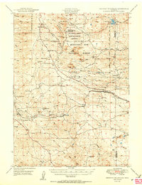
1950 Map of Sherman Mountains
USGS Topo · Published 1950About this map
The Medicine Bow National Forest dominates this mid-century landscape, serving as a backdrop for a complex mixture of military activity and pioneer-era transportation. Significant acreage is dedicated to the Fort Francis E Warren Target and Maneuver Reservation, while the Pole Mountain Military Reservation Headquarters and various ranger stations mark the administrative center of these highlands. The terrain is characterized by massive outcrops like Turtle Rock and the celebrated Vedauwoo Glen, features that have long drawn travelers along the southern Wyoming corridor.
Find a feature on this map
82 named features on this map. Tap any name to fly to it.
Don’t see what you’re looking for? This feature index may not catch every label — zoom into the map to look around manually.
Map Details
Editions of this 1950 Sherman Mountains Map
2 editions found
Other maps of this area

1895 · Laramie
USGS Topo · 1:125,000

1902 · Laramie
USGS Topo · 1:125,000

1905 · Sherman
USGS Topo · 1:125,000

1905 · Laramie
USGS Topo · 1:125,000

1906 · Laramie
USGS Topo · 1:125,000

1907 · Livermore
USGS Topo · 1:125,000

1908 · Laramie
USGS Topo · 1:125,000

1909 · Livermore
USGS Topo · 1:125,000

1916 · Home
USGS Topo · 1:125,000

1920 · Home
USGS Topo · 1:125,000