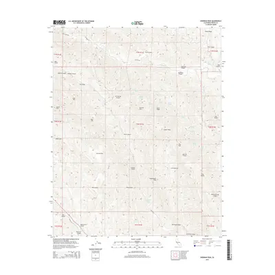
2015 Map of Sherman Peak
USGS Topo · Published 2015About this map
The Diablo Range defines this landscape in western Fresno County, where deep canyons and high peaks create a complex drainage network. Water is a central theme here, with numerous named springs such as Rock House Spring, Moonshine Spring, and Hollyhock Spring scattered across the ridges. These vital water sources historically supported ranching and transit through the dry interior mountains. The terrain is marked by prominent elevations including Sherman Peak, Kreyenhagen Peak, and Goat Mtn, which overlook landmarks like The Gorge and Devils Gate. The southern portion of the map highlights the area near Coalinga Mineral Springs, a location with deep ties to regional geological history. Key watercourses like Los Gatos Cr and Warthan Cr carve through the mountain passes, while Coalinga Rd provides the primary corridor through this section of the range.
Find a feature on this map
68 named features on this map. Tap any name to fly to it.
Don’t see what you’re looking for? This feature index may not catch every label — zoom into the map to look around manually.
Map Details
Editions of this 2015 Sherman Peak Map
This is the sole edition of this map. No revisions or reprints were ever made.
Other maps of this area

1912 · Coalinga
USGS Topo · 1:125,000

1915 · Priest Valley
USGS Topo · 1:125,000

1941 · Priest Valley
USGS Topo · 1:62,500

1943 · New Idria
USGS Topo · 1:62,500

1943 · Joaquin Rocks
USGS Topo · 1:62,500
1944 · Coalinga
USGS Topo · 1:62,500

1944 · Priest Valley
USGS Topo · 1:62,500

1948 · Santa Cruz
USGS Topo · 1:250,000

1955 · Santa Cruz
USGS Topo · 1:250,000
1956 · New Idria
USGS Topo · 1:62,500