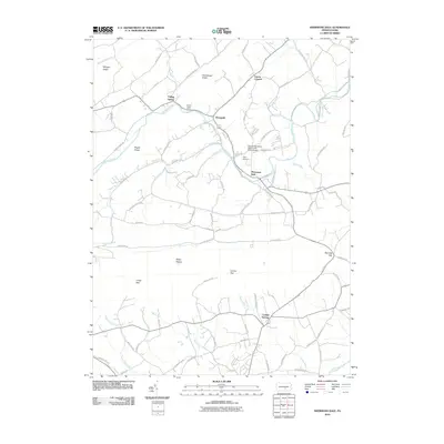
2010 Map of Shermans Dale
USGS Topo · Published 2010About this map
Shermans Dale and Carlisle Springs anchor this Pennsylvania landscape, where the geography is defined by a series of prominent ridges and the gaps that allow passage through them. The winding course of Sherman Creek dominates the northern half of the area, joined by tributaries such as Pisgah Run and Fishing Run, while the southern portion transitions toward the Conodoguinet Creek basin. These waterways and the steep elevations of Milligan Ridge, Rattlesnake Ridge, and Pisgah Ridge historically dictated the movement of people and the placement of small rural junctions like Dromgold and Crums Corners.
Find a feature on this map
78 named features on this map. Tap any name to fly to it.
Don’t see what you’re looking for? This feature index may not catch every label — zoom into the map to look around manually.
Map Details
Editions of this 2010 Shermans Dale Map
This is the sole edition of this map. No revisions or reprints were ever made.
Other maps of this area

1904 · Carlisle
USGS Topo · 1:62,500

1907 · New Bloomfield
USGS Topo · 1:62,500

1919 · Newville
USGS Topo · 1:62,500

1930 · Loysville
USGS Topo · 1:62,500

1933 · Loysville
USGS Topo · 1:62,500

1943 · New Bloomfield
USGS Topo · 1:62,500

1943 · Carlisle
USGS Topo · 1:62,500

1945 · Newville
USGS Topo · 1:62,500

1950 · Harrisburg
USGS Topo · 1:250,000
1952 · Ickesburg
USGS Topo · 1:24,000