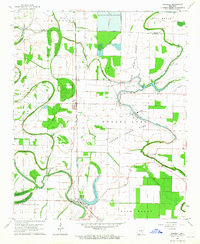
1963 Map of Sherrill
USGS Topo · Published 1965About this map
Agricultural operations and penal labor define this mid-century landscape in the Arkansas Delta, where the Tucker State Prison and its associated Tucker Prison Farm occupy a massive expanse of the bottomlands. The territory is defined by a dense network of drainage and transport, including the St. Louis Southwestern railroad which services the small settlements of Ferda, Tucker, and Sherrill. The landscape is heavily modified for large-scale farming, evidenced by the Main Ditch and numerous unnamed levees that manage the waters of Wabbaseka Bayou and Plum Bayou.
Find a feature on this map
37 named features on this map. Tap any name to fly to it.
Don’t see what you’re looking for? This feature index may not catch every label — zoom into the map to look around manually.
Map Details
Editions of this 1963 Sherrill Map
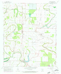
2 editions found
Other maps of this area

1891 · Little Rock
USGS Topo · 1:125,000

1893 · Little Rock
USGS Topo · 1:125,000

1932 · Pastoria
USGS Topo · 1:62,500

1935 · Altheimer
USGS Topo · 1:62,500

1935 · Pastoria
USGS Topo · 1:62,500

1937 · England
USGS Topo · 1:48,000

1939 · Keo
USGS Topo · 1:31,680

1941 · Keo
USGS Topo · 1:31,680

1943 · England
USGS Topo · 1:62,500

1948 · Helena
USGS Topo · 1:250,000