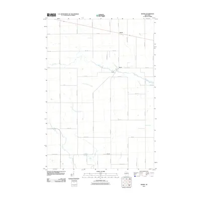
2010 Map of Sherry
USGS Topo · Published 2010About this map
Mill Creek meanders across this rural landscape, passing just south of the unincorporated settlement of Sherry, where Fairview Cemetery is established on the northern bank. The terrain is defined by a dense grid of township roads and agricultural properties, reflecting the long-standing dairy farming traditions of Wood County. To the north, the community of Blenker sits along a primary east-west route, while the southern reaches of the quadrangle are drained by Hemlock Creek and its various tributaries, including the East Fork Hemlock Creek. Local genealogy and land history are anchored by landmarks such as the Reformed Cemetery near the junction of County Hwy-HH and Lonely Rd. The map illustrates a modern rural infrastructure where family-named roads like Vruwink Rd and Lundberg Rd connect isolated farmsteads across the marshy lowlands of Moccasin Creek.
Find a feature on this map
44 named features on this map. Tap any name to fly to it.
Don’t see what you’re looking for? This feature index may not catch every label — zoom into the map to look around manually.
Map Details
Editions of this 2010 Sherry Map
This is the sole edition of this map. No revisions or reprints were ever made.
Other maps of this area

1953 · Eau Claire
USGS Topo · 1:250,000

1954 · Marshfield
USGS Topo · 1:62,500

1955 · Green Bay
USGS Topo · 1:250,000

1956 · Milladore
USGS Topo · 1:48,000

1957 · Wisconsin Rapids
USGS Topo · 1:48,000

1957 · Pittsville
USGS Topo · 1:48,000

1958 · Eau Claire
USGS Topo · 1:250,000

1964 · Eau Claire
USGS Topo · 1:250,000

1967 · Wisconsin Rapids
USGS Topo · 1:62,500

1967 · Pittsville
USGS Topo · 1:62,500