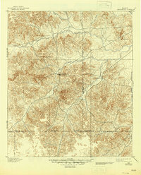
1895 Map of Sherwood
USGS Topo · Published 1945About this map
The Middle Concho River and its numerous tributaries dominate this high-plains landscape, which was surveyed during the late nineteenth century. The settlement of Sherwood serves as a central hub, positioned near the confluence of several drainages including Spring Creek and Dove Creek. This area, characterized by the prominent Lopez Peaks and the distant Twin Buttes, shows a distinct pattern of settlement following the watercourses through the limestone breaks of the Edwards Plateau. The presence of Knickerbocker to the east and Arden to the north illustrates the early ranching footprint in Irion and Tom Green counties. A network of primitive roads connects these outposts, crossing Rocky Creek and Live Oak Creek, reflecting a period before modern highway development when travel was dictated by the topography and river fords. Boundary lines for Irion, Tom Green, Schleicher, and Crockett counties intersect across the southern reach near the South Concho River.
Find a feature on this map
18 named features on this map. Tap any name to fly to it.
Don’t see what you’re looking for? This feature index may not catch every label — zoom into the map to look around manually.
Map Details
Editions of this 1895 Sherwood Map
5 editions found
Other maps of this area

1891 · Hayrick
USGS Topo · 1:125,000

1892 · San Angelo
USGS Topo · 1:125,000

1893 · Fort McKavett
USGS Topo · 1:125,000

1894 · Hayrick
USGS Topo · 1:125,000

1895 · Sherwood
USGS Topo · 1:125,000

1920 · Barnhart
USGS Topo · 1:62,500

1921 · Ketchum Mountain
USGS Topo · 1:62,500

1922 · Barnhart
USGS Topo · 1:62,500

1923 · Ketchum Mountain
USGS Topo · 1:62,500

1924 · San Angelo 2-c
USGS Topo · 1:48,000