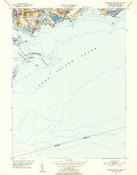
1951 Map of Sherwood Point
USGS Topo · Published 1952About this map
The coastal neighborhood of Saugatuck and the residential clusters of Compo Hills define this mid-century survey of the Connecticut shoreline. Settlement is concentrated along the western bank of the Saugatuck River, where the Westport Sta serves as a vital transit link near Hale Court. The landscape transitions from the developed streets of Compo to the preserved coastal wetlands and beaches of Sherwood Island State Park, illustrating the early 1950s balance between suburban growth and public shoreline access.
Find a feature on this map
38 named features on this map. Tap any name to fly to it.
Don’t see what you’re looking for? This feature index may not catch every label — zoom into the map to look around manually.
Map Details
Editions of this 1951 Sherwood Point Map
4 editions found
Other maps of this area

1891 · Bridgeport
USGS Topo · 1:62,500

1892 · Norwalk
USGS Topo · 1:62,500

1893 · Bridgeport
USGS Topo · 1:62,500

1893 · Norwalk
USGS Topo · 1:62,500

1901 · Northport
USGS Topo · 1:62,500

1902 · Setauket
USGS Topo · 1:62,500

1903 · Northport
USGS Topo · 1:62,500

1904 · Setauket
USGS Topo · 1:62,500

1904 · Islip
USGS Topo · 1:125,000

1919 · Setauket
USGS Topo · 1:62,500