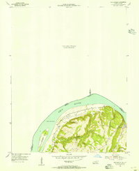
1954 Map of Shetlerville
USGS Topo · Published 1955About this map
The Ohio River curves sharply through this mid-century landscape, defining the state boundary between Illinois and Kentucky. On the Kentucky side, the small settlement of Carrsville serves as a focal point near the river's edge, nestled in an area where the terrain rises sharply from the floodplain. The map reveals a rural community deeply connected to its local geography, evidenced by the Givens Foot Trail winding through the wooded hills and the presence of Loves Chapel and the nearby Loves Cem. Downstream, the prominent Rondeau Island sits within the river channel, while inland features like Coalmine Hollow and Givens Creek suggest a history of small-scale resource extraction and natural drainage patterns that shaped early land use in Livingston County.
Find a feature on this map
13 named features on this map. Tap any name to fly to it.
Don’t see what you’re looking for? This feature index may not catch every label — zoom into the map to look around manually.
Map Details
Editions of this 1954 Shetlerville Map
This is the sole edition of this map. No revisions or reprints were ever made.
Other maps of this area

1916 · Golconda
USGS Topo · 1:62,500

1916 · Equality
USGS Topo · 1:62,500

1917 · Brownfield
USGS Topo · 1:62,500

1920 · Goloonda
USGS Topo · 1:48,000

1921 · Golconda
USGS Topo · 1:62,500

1925 · Harrisburg
USGS Topo · 1:62,500

1939 · Harrisburg
USGS Topo · 1:62,500

1949 · Paducah
USGS Topo · 1:250,000

1950 · Paducah
USGS Topo · 1:250,000

1954 · Paducah
USGS Topo · 1:250,000