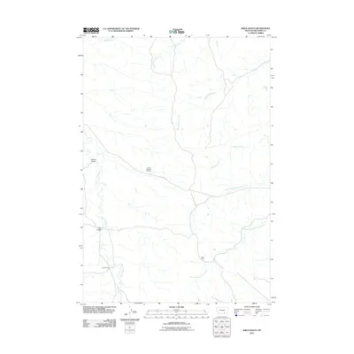
2011 Map of Shick Ranch
USGS Topo · Published 2011About this map
Shick Ranch and Barber Ranch anchor this landscape in Big Horn County, Montana, representing the rural homesteads that define the area's grazing and agricultural layout. The terrain is marked by a complex system of seasonal drainages, including the bifurcated North Fork Good Luck Creek and South Fork Good Luck Creek, which cut through the coulee-marked topography. Small-scale water management is evident at the Crow Number 67 Dam, while St Xavier Rd serves as the primary artery connecting these remote ranching operations. The drainage patterns of Sunday Creek and Rotten Grass Creek dictate the local geography, carving deep features like Mission Coulee and Ash Coulee into the Montana plains. This map provides a clear view of land use and water resources in the Crow Indian Reservation region during the early 21st century.
Find a feature on this map
12 named features on this map. Tap any name to fly to it.
Don’t see what you’re looking for? This feature index may not catch every label — zoom into the map to look around manually.
Map Details
Editions of this 2011 Shick Ranch Map
This is the sole edition of this map. No revisions or reprints were ever made.
Other maps of this area

1894 · Rosebud
USGS Topo · 1:125,000

1894 · St. Xavier
USGS Topo · 1:125,000

1901 · Rosebud
USGS Topo · 1:125,000

1901 · St. Xavier
USGS Topo · 1:125,000

1954 · Hardin
USGS Topo · 1:250,000

1957 · Hardin
USGS Topo · 1:250,000

1958 · Hardin
USGS Topo · 1:250,000

1960 · Schick Ranch
USGS Topo · 1:24,000

1960 · St Xavier
USGS Topo · 1:24,000

1960 · St Xavier NE
USGS Topo · 1:24,000