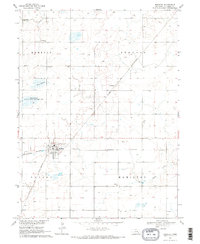
1969 Map of Shickley
USGS Topo · Published 1971About this map
Shickley serves as the primary hub of this Fillmore County landscape, situated at the junction of the Burlington Northern and the Chicago and North Western railroads. The town’s layout is documented alongside its local infrastructure, including a Sewage Disposal plant and the nearby Shickley Cem. To the north, the small siding of Martland sits along the rail line, while the surrounding prairie is dotted with অসংখ্য agricultural wells and family-serving landmarks such as St Marys Ch, Salem Ch, and Zion Cem.
Find a feature on this map
18 named features on this map. Tap any name to fly to it.
Don’t see what you’re looking for? This feature index may not catch every label — zoom into the map to look around manually.
Map Details
Editions of this 1969 Shickley Map
2 editions found
Other maps of this area

1898 · York
USGS Topo · 1:125,000

1898 · Hebron
USGS Topo · 1:125,000

1899 · York
USGS Topo · 1:125,000

1955 · Lincoln
USGS Topo · 1:250,000

1957 · Lincoln
USGS Topo · 1:250,000

1958 · Lincoln
USGS Topo · 1:250,000

1960 · Bruning
USGS Topo · 1:24,000

1960 · Davenport
USGS Topo · 1:24,000

1960 · Carleton
USGS Topo · 1:24,000
1969 · Ong
USGS Topo · 1:24,000