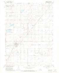
1969 Map of Shickley
USGS Topo · Published 1971About this map
Shickley serves as the primary hub of this late 1960s agricultural survey in Fillmore County, positioned at the junction of the Burlington Northern and Chicago and North Western railroads. The town's layout includes a localized Sewage Disposal plant and the Shickley Cem, while the surrounding prairie is dotted with remote landmarks such as St Marys Ch and Zion Cem. The landscape reflects a transition between managed conservation and traditional farming, notably within the Mallard Haven National Wildlife Management Area and around seasonal water features like Weis Lagoon.
Find a feature on this map
19 named features on this map. Tap any name to fly to it.
Don’t see what you’re looking for? This feature index may not catch every label — zoom into the map to look around manually.
Map Details
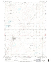
Editions of this 1969 Shickley Map
2 editions found
Other maps of this area
1898 · York
USGS Topo · 1:125,000
1898 · Hebron
USGS Topo · 1:125,000
1899 · York
USGS Topo · 1:125,000
1955 · Lincoln
USGS Topo · 1:250,000
1957 · Lincoln
USGS Topo · 1:250,000
1958 · Lincoln
USGS Topo · 1:250,000
1960 · Bruning
USGS Topo · 1:24,000
1960 · Davenport
USGS Topo · 1:24,000
1960 · Carleton
USGS Topo · 1:24,000
1969 · Ong
USGS Topo · 1:24,000