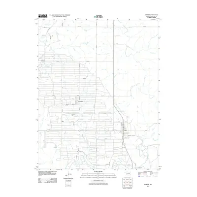
2012 Map of Shidler
USGS Topo · Published 2012About this map
The Burbank Oil Field dominates the landscape of northern Osage County in this contemporary survey, reflecting the deep industrial roots of the region. The map reveals the intricate grid of county roads, such as n3530 RD and e0150 RD, that service the oil infrastructure and connect small communities. The town of Shidler serves as a local hub, situated near the intersection of several municipal streets including Broadway ST and Barber ST e0163 RD.
Find a feature on this map
61 named features on this map. Tap any name to fly to it.
Don’t see what you’re looking for? This feature index may not catch every label — zoom into the map to look around manually.
Map Details
Editions of this 2012 Shidler Map
This is the sole edition of this map. No revisions or reprints were ever made.
Other maps of this area

1916 · Foraker
USGS Topo · 1:62,500

1932 · Fairfax
USGS Topo · 1:62,500

1935 · Kaw
USGS Topo · 1:62,500

1936 · Belford
USGS Topo · 1:62,500

1955 · Enid
USGS Topo · 1:250,000

1958 · Enid
USGS Topo · 1:250,000

1964 · Charley Creek NE
USGS Topo · 1:24,000

1964 · Kaw City
USGS Topo · 1:24,000
1964 · Shidler
USGS Topo · 1:24,000
1964 · Hardy
USGS Topo · 1:24,000