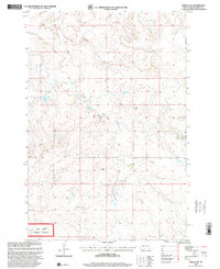
1998 Map of Shields SW
USGS Topo · Published 2001About this map
Cedar River National Grassland encompasses the southwestern portion of this Sioux County landscape, protecting the native prairie ecosystems that define this region of the Standing Rock Indian Reservation. This map, based on topographic surveys from the 1970s and 1990s, documents a sparsely populated rural terrain marked by intermittent drainage systems and high-plains geography. The winding path of Leaf on the Hill Creek traverses the northern sections, while scattered landmarks such as a isolated Windmill and a small Gravel Pit indicate the local ranching and maintenance activity of the late twentieth century. These features reflect the enduring agricultural and conservation priorities of the North Dakota plains, providing a detailed record of land use within the national grassland boundaries.
Find a feature on this map
6 named features on this map. Tap any name to fly to it.
Don’t see what you’re looking for? This feature index may not catch every label — zoom into the map to look around manually.
Map Details
Editions of this 1998 Shields SW Map
This is the sole edition of this map. No revisions or reprints were ever made.
Other maps of this area

1953 · McIntosh
USGS Topo · 1:250,000

1954 · Bismarck
USGS Topo · 1:250,000

1958 · Bismarck
USGS Topo · 1:250,000

1958 · McIntosh
USGS Topo · 1:250,000

1971 · Shields SW
USGS Topo · 1:24,000

1971 · Shields
USGS Topo · 1:24,000

1971 · Lookout Butte SE
USGS Topo · 1:24,000

1971 · Porcupine
USGS Topo · 1:24,000

1971 · Pamplin Hills
USGS Topo · 1:24,000

1972 · Walker
USGS Topo · 1:24,000