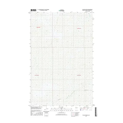
2016 Map of Shilling Dam NE
USGS Topo · Published 2016About this map
Rapid River and its North Branch Rapid River anchor this 2016 survey of the northern Minnesota wetlands. Located within Lake of the Woods County, the landscape is defined by an extensive system of marshes and slow-moving waterways, including the winding course of Meadow Cr in the northeast. Human presence is light, concentrated primarily along the southern edge where Rapid River Rd Sw provides the principal means of access through the terrain. The map serves as a contemporary record of the Public Land Survey System, clearly delineating the boundaries of township and range lines like t158n r34w and t157n r35w. This documentation is essential for understanding land management and conservation efforts in one of the state's most ecologically distinct northern reaches.
Find a feature on this map
8 named features on this map. Tap any name to fly to it.
Don’t see what you’re looking for? This feature index may not catch every label — zoom into the map to look around manually.
Map Details
Editions of this 2016 Shilling Dam NE Map
This is the sole edition of this map. No revisions or reprints were ever made.
Other maps of this area

1918 · Winterroad
USGS Topo · 1:62,500

1918 · F
USGS Topo · 1:62,500

1919 · Peppermint Creek
USGS Topo · 1:62,500

1919 · G
USGS Topo · 1:62,500

1943 · Peppermint Creek
USGS Topo · 1:62,500

1954 · Roseau
USGS Topo · 1:250,000

1957 · Roseau
USGS Topo · 1:250,000

1958 · Roseau
USGS Topo · 1:250,000
1968 · Graceton SW
USGS Topo · 1:24,000
1969 · Winter Road Lake SE
USGS Topo · 1:24,000