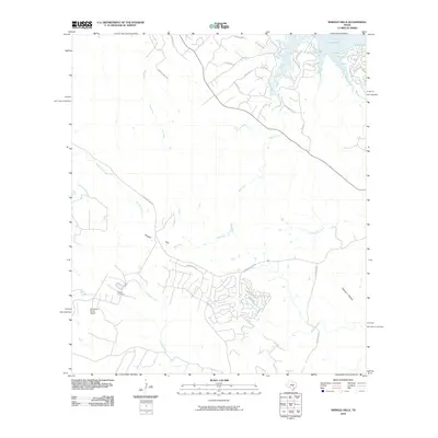
2010 Map of Shingle Hills
USGS Topo · Published 2010About this map
Lake Travis and the Colorado River define the northern boundary of this central Texas landscape, where the plateau begins to break into a series of deeply etched drainages. The topography is dominated by the Shingle Hills and dissected by numerous waterways including Bee Creek, Lick Creek, and Fitzhugh Creek. This 2010 snapshot reveals a transition from traditional ranching lands to modern residential development, most notably around the Lakeway Blvd area. Local history is anchored by the Peryear Cemetery located near the western edge of the quadrangle. Transportation and land use are centered on Hamilton Pool Rd, which serves as a primary artery through the hilly terrain. The presence of the Alexander Ranch Airport and the scattered settlement at Bell Spring illustrate the mix of private aviation and rural residence characteristic of this region west of Austin.
Find a feature on this map
31 named features on this map. Tap any name to fly to it.
Don’t see what you’re looking for? This feature index may not catch every label — zoom into the map to look around manually.
Map Details
Editions of this 2010 Shingle Hills Map
This is the sole edition of this map. No revisions or reprints were ever made.
Other maps of this area

1887 · Blanco
USGS Topo · 1:125,000

1894 · Blanco
USGS Topo · 1:125,000

1896 · Austin
USGS Topo · 1:125,000

1897 · Austin
USGS Topo · 1:125,000

1910 · Austin
USGS Topo · 1:125,000

1930 · Austin-2
USGS Topo · 1:48,000

1930 · Blanco-1
USGS Topo · 1:48,000

1932 · Mt. Bonnell
USGS Topo · 1:62,500

1954 · Llano
USGS Topo · 1:250,000

1954 · Austin
USGS Topo · 1:250,000