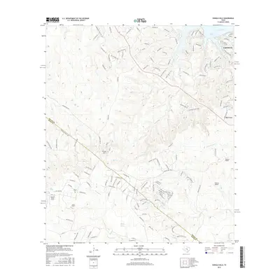
2016 Map of Shingle Hills
USGS Topo · Published 2016About this map
The Colorado River and the southern reaches of Lake Travis dominate the northern landscape of this region, where the residential development of Lakeway meets the rising terrain of the Texas Hill Country. To the south, the eponymous Shingle Hills rise above a complex network of waterways, including Bee Cr and Fitzhugh Cr, which carve through the limestone landscape toward Barton Creek Springs. The map documents a blend of established ranching heritage and modern aviation, as seen at the Alexander Ranch Airport and Ohho Airport. Local history is preserved at the Peryear Cem, while the rugged relief is marked by features like Noack Hill and the deep cuts of Hickson Hollow. Numerous springs, including Hamilton Spring and Bell Spring, point to the hydrologic importance of this area along the Travis and Hays county line.
Find a feature on this map
134 named features on this map. Tap any name to fly to it.
Don’t see what you’re looking for? This feature index may not catch every label — zoom into the map to look around manually.
Map Details
Editions of this 2016 Shingle Hills Map
This is the sole edition of this map. No revisions or reprints were ever made.
Other maps of this area

1887 · Blanco
USGS Topo · 1:125,000

1894 · Blanco
USGS Topo · 1:125,000

1896 · Austin
USGS Topo · 1:125,000

1897 · Austin
USGS Topo · 1:125,000

1910 · Austin
USGS Topo · 1:125,000

1930 · Austin-2
USGS Topo · 1:48,000

1930 · Blanco-1
USGS Topo · 1:48,000

1932 · Mt. Bonnell
USGS Topo · 1:62,500

1954 · Llano
USGS Topo · 1:250,000

1954 · Austin
USGS Topo · 1:250,000