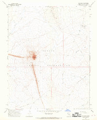
1966 Map of Ship Rock
USGS Topo · Published 1969About this map
The geological landmark Ship Rock dominates this mid-1960s topographic survey of the Navajo Indian Reservation. This map reveals the striking volcanic topography of the high desert, including the prominent radiating Dike structure that extends southward from the central peak. Beyond the geological features, the landscape is defined by the energy infrastructure of the era, specifically the Rattlesnake Oil Field and the Shiprock-Gallup Oil Field. A network of access roads, an industrial Pipeline, and various marked Drill Holes illustrate the intersection of traditional land and modern resource extraction. Drainage patterns are represented by the seasonal paths of Shiprock Wash and Rattlesnake Wash, while the Red Rock Highway provides the primary transit route through this remote section of San Juan County.
Find a feature on this map
10 named features on this map. Tap any name to fly to it.
Don’t see what you’re looking for? This feature index may not catch every label — zoom into the map to look around manually.
Map Details
Editions of this 1966 Ship Rock Map
3 editions found
Other maps of this area

1889 · Chaco
USGS Topo · 1:250,000

1892 · Chaco
USGS Topo · 1:250,000

1927 · Sulphur Spring
USGS Topo · 1:96,000

1928 · Kirtland
USGS Topo · 1:125,000

1932 · Kirtland
USGS Topo · 1:125,000

1934 · Ship Rock
USGS Topo · 1:62,500

1934 · Chimney Rock
USGS Topo · 1:62,500

1934 · Rattlesnake
USGS Topo · 1:62,500

1936 · Chimney Rock
USGS Topo · 1:62,500

1937 · Ship Rock
USGS Topo · 1:62,500