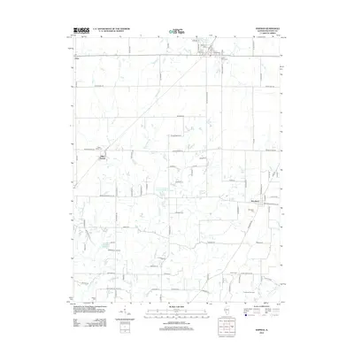
2012 Map of Shipman
USGS Topo · Published 2012About this map
Piasa, Miles Station, and Woodburn anchor this northern Macoupin County landscape, where the prairie transitions into the drainage basins of the W Fork Wood River and E Fork Wood River. The map reveals a deeply rooted rural community, evidenced by numerous family and local burial grounds including Shipman Cem, Saint Denis Cem, and Stewart Cem. The local economy and land use are characterized by agricultural facilities like the Puregenis Pork Farm and water management features such as the Shipman Reservoir and the uniquely designated Illinois No Name Number 2042 Reservoir. A dense grid of secondary roads, from Shipman Cutoff Rd to Brighton Bunker Hill Rd, connects these small settlements and outlying farmsteads, tracing the development of this Illinois farming region.
Find a feature on this map
91 named features on this map. Tap any name to fly to it.
Don’t see what you’re looking for? This feature index may not catch every label — zoom into the map to look around manually.
Map Details
Editions of this 2012 Shipman Map
This is the sole edition of this map. No revisions or reprints were ever made.
Other maps of this area

1912 · Gillespie
USGS Topo · 1:62,500

1915 · Gillespie
USGS Topo · 1:62,500

1925 · Brighton
USGS Topo · 1:62,500

1927 · Alton
USGS Topo · 1:62,500

1927 · Edwardsville
USGS Topo · 1:62,500

1928 · Brighton
USGS Topo · 1:62,500

1932 · Edwardsville
USGS Topo · 1:62,500

1934 · Alton
USGS Topo · 1:62,500

1948 · Quincy
USGS Topo · 1:250,000
1948 · Alton
USGS Topo · 1:24,000