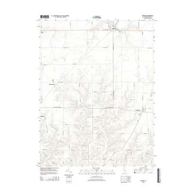
2015 Map of Shipman
USGS Topo · Published 2015About this map
Shipman and the surrounding farm country of Macoupin County appear in this 2015 study, defined by the headwaters of the Wood River and a network of rural routes. The landscape transitions from the residential blocks of Shipman and Brighton to the smaller settlements of Miles Station and Piasa. Local heritage is anchored by several historic burial grounds, including the Saint Denis Cem and the Woodburn Cem, while the topography is shaped by the winding Piasa Cr and Honeycut Br. Water resources are central to the area, evidenced by the Shipman Reservoir and the Illinois No Name Number 2042 Reservoir, which interrupt the agricultural grid. This survey preserves the modern footprint of these crossroads communities, recording the enduring locations of family landmarks like the Stewart Cem and the Woods Cem.
Find a feature on this map
42 named features on this map. Tap any name to fly to it.
Don’t see what you’re looking for? This feature index may not catch every label — zoom into the map to look around manually.
Map Details
Editions of this 2015 Shipman Map
This is the sole edition of this map. No revisions or reprints were ever made.
Other maps of this area

1912 · Gillespie
USGS Topo · 1:62,500

1915 · Gillespie
USGS Topo · 1:62,500

1925 · Brighton
USGS Topo · 1:62,500

1927 · Alton
USGS Topo · 1:62,500

1927 · Edwardsville
USGS Topo · 1:62,500

1928 · Brighton
USGS Topo · 1:62,500

1932 · Edwardsville
USGS Topo · 1:62,500

1934 · Alton
USGS Topo · 1:62,500

1948 · Quincy
USGS Topo · 1:250,000
1948 · Alton
USGS Topo · 1:24,000