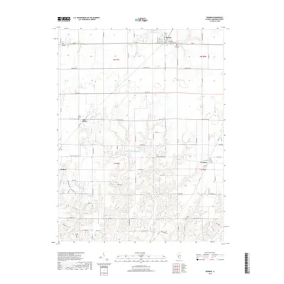
2018 Map of Shipman
USGS Topo · Published 2018About this map
Shipman stands at the northern edge of this Illinois landscape, where the intersection of W Railroad St and Prairie St anchors a community defined by its proximity to the Shipman Reservoir. To the south, the terrain transitions into the headwaters of the W Fork Wood River and E Fork Wood River, where drainage patterns create a more complex topography than the agricultural plains found near Piasa. Small, long-established hamlets like Miles Station and Woodburn are centered around their respective burial grounds, such as Miles Station Cem and Woodburn Cem.
Find a feature on this map
84 named features on this map. Tap any name to fly to it.
Don’t see what you’re looking for? This feature index may not catch every label — zoom into the map to look around manually.
Map Details
Editions of this 2018 Shipman Map
This is the sole edition of this map. No revisions or reprints were ever made.
Other maps of this area

1912 · Gillespie
USGS Topo · 1:62,500

1915 · Gillespie
USGS Topo · 1:62,500

1925 · Brighton
USGS Topo · 1:62,500

1927 · Alton
USGS Topo · 1:62,500

1927 · Edwardsville
USGS Topo · 1:62,500

1928 · Brighton
USGS Topo · 1:62,500

1932 · Edwardsville
USGS Topo · 1:62,500

1934 · Alton
USGS Topo · 1:62,500

1948 · Quincy
USGS Topo · 1:250,000
1948 · Alton
USGS Topo · 1:24,000