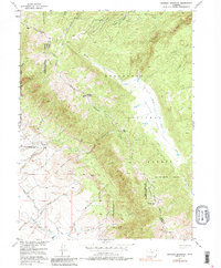
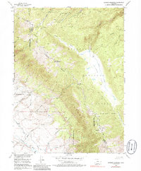
1955 Map of Shipman Mountain
USGS Topo · Published 1985About this map
Shipman Mountain stands at the center of this high-altitude landscape along the border of Jackson and Larimer Counties. In the mid-1950s, the area was defined by its transition between the Roosevelt and Routt National Forests, intersected by the high-elevation Ute Pass. The drainage patterns are complex, with the Medicine Bow River and Canadian River flowing through the southern reaches, while Grace Creek and Forrester Creek carve out the northern terrain.
Find a feature on this map
30 named features on this map. Tap any name to fly to it.
Don’t see what you’re looking for? This feature index may not catch every label — zoom into the map to look around manually.
Map Details
Editions of this 1955 Shipman Mountain Map
6 editions found
Other maps of this area

1916 · Home
USGS Topo · 1:125,000

1920 · Home
USGS Topo · 1:125,000

1950 · Kings Canyon
USGS Topo · 1:24,000

1952 · Kings Canyon
USGS Topo · 1:24,000

1954 · Greeley
USGS Topo · 1:250,000

1954 · Craig
USGS Topo · 1:250,000

1955 · Old Roach
USGS Topo · 1:24,000

1955 · Eagle Hill
USGS Topo · 1:24,000

1955 · Shipman Mountain
USGS Topo · 1:24,000

1955 · Gould NW
USGS Topo · 1:24,000