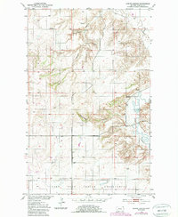
1950 Map of Shippe Canyon
USGS Topo · Published 1989About this map
The Fort Peck Indian Reservation defines the southern portion of this landscape, where the northern plains are deeply etched by drainage systems like Richardson Coulee and Shippe Canyon. This 1950s-era topography reveals a sparse, resource-driven settlement pattern characterized by isolated infrastructure and small-scale extraction. Evidence of earlier coal mining is scattered throughout the area, with several Coal Mines (Inactive) and an individual Coal Mine (Inactive) noted, suggesting a shift away from local mineral production by the mid-20th century.
Find a feature on this map
14 named features on this map. Tap any name to fly to it.
Don’t see what you’re looking for? This feature index may not catch every label — zoom into the map to look around manually.
Map Details
Editions of this 1950 Shippe Canyon Map
2 editions found
Other maps of this area

1948 · Reserve
USGS Topo · 1:24,000

1948 · Alkali Coulee
USGS Topo · 1:24,000

1948 · Antelope
USGS Topo · 1:24,000

1949 · Reserve
USGS Topo · 1:24,000

1949 · Antelope
USGS Topo · 1:24,000

1949 · Alkali Coulee
USGS Topo · 1:24,000

1950 · Shippe Canyon
USGS Topo · 1:24,000

1954 · Wolf Point
USGS Topo · 1:250,000

1958 · Wolf Point
USGS Topo · 1:250,000

1983 · Dooley SW
USGS Topo · 1:24,000