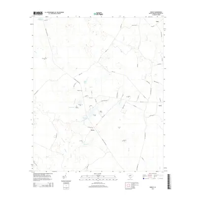
2014 Map of Shirley
USGS Topo · Published 2014About this map
Augusta Stagecoach Rd and Jericho Rd anchor the landscape of Hampton County in this 2014 survey. The settlement of Shirley is the central point of a road network that includes Coon Club Loop and Shirley Rd, reflecting a rural South Carolina character defined by small communities and family-named landmarks. The area is notable for its concentration of burial grounds, such as Old Lawtonville Cem, Union Cem, and Solomons Cem, which provide significant points of interest for genealogists and local historians tracking early residents. Low-lying drainage patterns are evident through the meandering Daley Branch and Millpond Br, which feed various local water bodies including Ramseys Pond and Lafitte Pond. To the east, the map captures portions of Estill and Scotia, connected by roads like Wilson Dr and Old Orangeburg Rd.
Find a feature on this map
57 named features on this map. Tap any name to fly to it.
Don’t see what you’re looking for? This feature index may not catch every label — zoom into the map to look around manually.
Map Details
Editions of this 2014 Shirley Map
This is the sole edition of this map. No revisions or reprints were ever made.
Other maps of this area

1918 · Varnville
USGS Topo · 1:62,500

1919 · Pineland
USGS Topo · 1:62,500

1919 · Shirley
USGS Topo · 1:62,500

1920 · Peeples
USGS Topo · 1:62,500

1943 · Pineland
USGS Topo · 1:62,500

1943 · Peeples
USGS Topo · 1:62,500

1943 · Shirley
USGS Topo · 1:62,500

1944 · Varnville
USGS Topo · 1:62,500

1947 · Savannah
USGS Topo · 1:250,000

1948 · Savannah
USGS Topo · 1:250,000