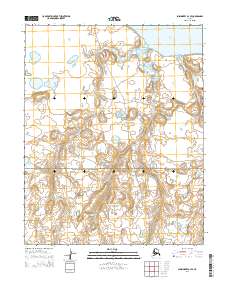
2014 Map of Shishmaref A-3 SE
USGS Topo · Published 2014About this map
Bering Land Bridge National Preserve dominates the southern landscape of this coastal Alaskan region, preserving a critical link to the ancient migration route between continents. In the north, the waters of Shishmaref Inlet reach into the tundra, fed by a network of drainage systems including Tin Cr and Goose Cr. The terrain is defined by low-lying wetlands and complex hydrography, characteristic of the Seward Peninsula's northern reaches. This 2014 survey documents the topographic layout of the area near the Bering Strait, highlighting the intersection of federal protected lands and the shifting coastal environment during a period of increasing focus on Arctic conservation.
Find a feature on this map
10 named features on this map. Tap any name to fly to it.
Don’t see what you’re looking for? This feature index may not catch every label — zoom into the map to look around manually.
Map Details
Editions of this 2014 Shishmaref A-3 SE Map
This is the sole edition of this map. No revisions or reprints were ever made.
Other maps of this area

1950 · Teller
USGS Topo · 1:250,000

1950 · Shishmaref
USGS Topo · 1:250,000

1950 · Teller D-2
USGS Topo · 1:63,360

1950 · Teller D-3
USGS Topo · 1:63,360

1950 · Shishmaref A-2
USGS Topo · 1:63,360

1950 · Shishmaref A-3
USGS Topo · 1:63,360

1951 · Shishmaref
USGS Topo · 1:250,000

1951 · Teller
USGS Topo · 1:250,000

1957 · Teller
USGS Topo · 1:250,000

1958 · Teller
USGS Topo · 1:250,000