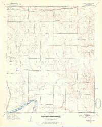
1951 Map of Shoals
USGS Topo · Published 1952About this map
The Red River marks the southern boundary of this Oklahoma-Texas borderland, where the terrain transitions from the floodplain to the northern uplands of Everidge. In the early 1950s, the landscape was defined by a dense network of rural community institutions, evidenced by the numerous schools such as Bearden Springs Sch and Shoat Springs Sch scattered across the countryside. The northern edge is dominated by the St Louis San Francisco railroad corridor, passing through the settlement of Fallon. Along the river bottom, a large Fish Hatchery and several creek systems, including Carney Creek and Horse Creek, illustrate the importance of water management in this agricultural region. Smaller hamlets like Ord and Shoals anchor the south, while community life is traced through scattered sites like Shoals Chapel Sch and Jones Cem.
Find a feature on this map
33 named features on this map. Tap any name to fly to it.
Don’t see what you’re looking for? This feature index may not catch every label — zoom into the map to look around manually.
Map Details
Editions of this 1951 Shoals Map
2 editions found

Other maps of this area

1901 · Antlers
USGS Topo · 1:125,000

1901 · Alikchi
USGS Topo · 1:125,000

1903 · Paris
USGS Topo · 1:125,000

1912 · Antlers
USGS Topo · 1:125,000

1925 · Antlers
USGS Topo · 1:125,000

1948 · Grant
USGS Topo · 1:62,500

1949 · Grant
USGS Topo · 1:62,500

1950 · Mcalester
USGS Topo · 1:250,000

1951 · Slate Shoals
USGS Topo · 1:24,000

1951 · Frogville
USGS Topo · 1:24,000