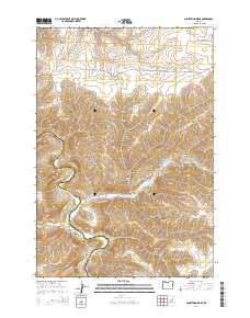
2014 Map of Shoestring Ridge
USGS Topo · Published 2014About this map
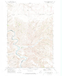
Thirtymile Cr carves through this high desert plateau along the border of Sherman and Gilliam counties, defining a landscape of deep canyons and prominent basaltic formations. The drainage network is dense with named breaks including Richmond Canyon, Armstrong Canyon, and the appropriately named Devils Canyon. High points such as Nelson Butte and Table Rock provide topographic anchors for the surrounding range, while the distinctive North Pole Ridge and Shoestring Ridge dictate the flow of the intermittent waterways. This area, largely defined by ranching and grazing access, is serviced by remote corridors like Richmond Ln and Seales Rd. Water sources are critical in this arid terrain, with Schilling Spring serving as a vital landmark. The map documents the intricate natural boundary between the two counties as it follows the sinuous path of the local creek beds.
Find a feature on this map
40 named features on this map. Tap any name to fly to it.
Don’t see what you’re looking for? This feature index may not catch every label — zoom into the map to look around manually.
Map Details
Editions of this 2014 Shoestring Ridge Map
This is the sole edition of this map. No revisions or reprints were ever made.
Other maps of this area

1916 · Condon
USGS Topo · 1:125,000

1953 · The Dalles
USGS Topo · 1:250,000

1956 · The Dalles
USGS Topo · 1:250,000

1957 · The Dalles
USGS Topo · 1:250,000

1970 · Igo Butte
USGS Topo · 1:24,000
1970 · Schott Canyon
USGS Topo · 1:24,000
1970 · Chimney Springs
USGS Topo · 1:24,000

1970 · Indian Cove
USGS Topo · 1:24,000
1970 · Buckhorn Canyon
USGS Topo · 1:24,000
1970 · Shoestring Ridge
USGS Topo · 1:24,000