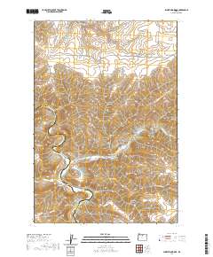
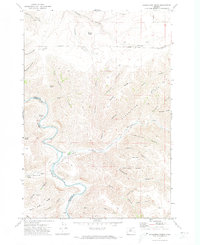
2020 Map of Shoestring Ridge
USGS Topo · Published 2020About this map
Shoestring Ridge and the complex drainage systems of the John Day River define this high-desert plateau along the Sherman and Gilliam County line. The landscape is carved by deep water-cut features such as Thirtymile Creek and Buckskin Canyon, which emphasize the high relief between the river basin and landmarks like Nelson Butte and Table Rock. This modern survey illustrates how long-established rural paths like Richmond Road and Armstrong Canyon Road navigate the difficult terrain of the Columbia Plateau.
Find a feature on this map
43 named features on this map. Tap any name to fly to it.
Don’t see what you’re looking for? This feature index may not catch every label — zoom into the map to look around manually.
Map Details
Editions of this 2020 Shoestring Ridge Map
This is the sole edition of this map. No revisions or reprints were ever made.
Other maps of this area

1916 · Condon
USGS Topo · 1:125,000

1953 · The Dalles
USGS Topo · 1:250,000

1956 · The Dalles
USGS Topo · 1:250,000

1957 · The Dalles
USGS Topo · 1:250,000

1970 · Igo Butte
USGS Topo · 1:24,000
1970 · Schott Canyon
USGS Topo · 1:24,000
1970 · Chimney Springs
USGS Topo · 1:24,000

1970 · Indian Cove
USGS Topo · 1:24,000
1970 · Buckhorn Canyon
USGS Topo · 1:24,000
1970 · Shoestring Ridge
USGS Topo · 1:24,000