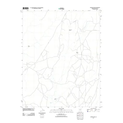
2011 Map of Shonto NW
USGS Topo · Published 2011About this map
Shonto Plateau dominates this high-altitude landscape in the Navajo Nation, defined by a complex network of canyons and washes that reveal the region's geological character. In the early 21st century, this area remains characterized by its drainage systems and ephemeral water sources, such as Cliff Spring Canyon and Geshi Canyon. The presence of Adadkā Spring and Sand Spring suggests the vital importance of natural water points in this arid environment. Transportation through this part of Navajo County is facilitated by several numbered tribal routes, including Indian Rte-16 and Indian Rte-6310, which connect the high plateaus with drainage basins like Last End Wash. The map illustrates the sparse, high-desert infrastructure common to this portion of northern Arizona.
Find a feature on this map
10 named features on this map. Tap any name to fly to it.
Don’t see what you’re looking for? This feature index may not catch every label — zoom into the map to look around manually.
Map Details
Editions of this 2011 Shonto NW Map
This is the sole edition of this map. No revisions or reprints were ever made.
Other maps of this area

1883 · Marsh Pass
USGS Topo · 1:250,000

1892 · Marsh Pass
USGS Topo · 1:250,000

1956 · Marble Canyon
USGS Topo · 1:250,000

1959 · Marble Canyon
USGS Topo · 1:250,000

1961 · Marble Canyon
USGS Topo · 1:250,000

1970 · Whirlwind Rock
USGS Topo · 1:24,000

1970 · Shonto SE
USGS Topo · 1:24,000
1970 · Betatakin Ruin
USGS Topo · 1:24,000
1970 · Tall Mountain
USGS Topo · 1:24,000
1970 · Shonto
USGS Topo · 1:24,000