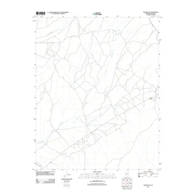
2011 Map of Shonto SE
USGS Topo · Published 2011About this map
Shonto Wash meanders across this high desert landscape in Navajo County, creating a complex drainage network that defines the local geography. This 2011 survey by the U.S. Geological Survey illustrates a sparsely populated region where transportation is primarily governed by long-established routes such as Indian Rte 221 and Indian Rte 6312. To the north, the terrain is further segmented by the seasonal flow of John Smith Wash. The network of local roads and trails shown here suggests a landscape managed and traversed for decades, providing a detailed view of the infrastructure connecting various parts of the Shonto SE quadrangle before the digital-mapping era became more automated.
Find a feature on this map
4 named features on this map. Tap any name to fly to it.
Don’t see what you’re looking for? This feature index may not catch every label — zoom into the map to look around manually.
Map Details
Editions of this 2011 Shonto SE Map
This is the sole edition of this map. No revisions or reprints were ever made.
Other maps of this area

1883 · Marsh Pass
USGS Topo · 1:250,000

1892 · Marsh Pass
USGS Topo · 1:250,000

1956 · Marble Canyon
USGS Topo · 1:250,000

1959 · Marble Canyon
USGS Topo · 1:250,000

1961 · Marble Canyon
USGS Topo · 1:250,000

1968 · Marsh Pass
USGS Topo · 1:24,000

1970 · Black Mesa Wash NW
USGS Topo · 1:24,000

1970 · Shonto SE
USGS Topo · 1:24,000
1970 · Betatakin Ruin
USGS Topo · 1:24,000
1970 · Shonto
USGS Topo · 1:24,000