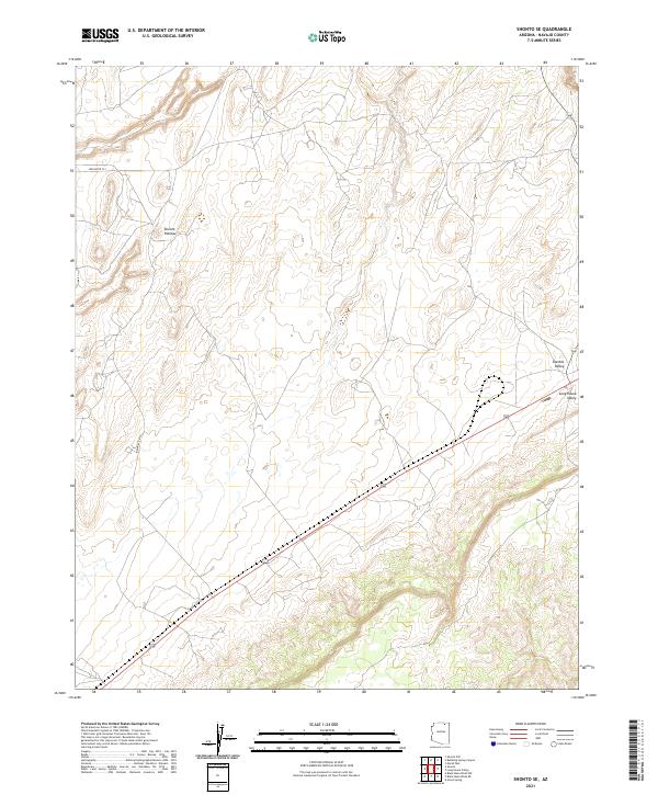
2021 Map of Shonto SE
USGS Topo · Published 2021About this map
The Shonto Plateau dominates the northern landscape of this Navajo County quadrangle, where high-elevation terrain meets the dramatic descents of the eastern Arizona desert. The map illustrates a region defined by its broad geological formations rather than dense settlement, highlighting the transition between the plateau and the lower-lying Klethla Valley and Long House Valley to the southeast. These valleys serve as natural corridors for transportation, marked by the routes that cut through the topography. Modern infrastructure is represented by Indian Rte 221 and Indian Rte 6312, which provide access through this expansive tribal land. The survey detail reflects a landscape of significant relief, where contour lines reveal the intricate drainage patterns and mesa edges that characterize the Shonto region.
Find a feature on this map
9 named features on this map. Tap any name to fly to it.
Don’t see what you’re looking for? This feature index may not catch every label — zoom into the map to look around manually.
Map Details
Editions of this 2021 Shonto SE Map
This is the sole edition of this map. No revisions or reprints were ever made.
Other maps of this area

1883 · Marsh Pass
USGS Topo · 1:250,000

1892 · Marsh Pass
USGS Topo · 1:250,000

1956 · Marble Canyon
USGS Topo · 1:250,000

1959 · Marble Canyon
USGS Topo · 1:250,000

1961 · Marble Canyon
USGS Topo · 1:250,000

1968 · Marsh Pass
USGS Topo · 1:24,000

1970 · Black Mesa Wash NW
USGS Topo · 1:24,000

1970 · Shonto SE
USGS Topo · 1:24,000
1970 · Betatakin Ruin
USGS Topo · 1:24,000
1970 · Shonto
USGS Topo · 1:24,000