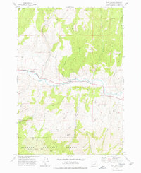
1972 Map of Shop Gulch
USGS Topo · Published 1977About this map
The John Day River carves a central path through this section of Grant County, serving as the primary geographic corridor for transport and settlement. At Moores Crossing, a cluster of benchmarks and building footprints indicates a pocket of human activity along the river's edge, while a Footbridge further east provides a crossing point for those navigating the riparian landscape. The northern half of the map is defined by a series of steep drainages, including Shop Gulch, Belshaw Creek, and Cummings Creek, which flow southward toward the river valley.
Find a feature on this map
40 named features on this map. Tap any name to fly to it.
Don’t see what you’re looking for? This feature index may not catch every label — zoom into the map to look around manually.
Map Details
Editions of this 1972 Shop Gulch Map
2 editions found
Other maps of this area

1940 · Mount Vernon
USGS Topo · 1:62,500

1940 · Aldrich Mtn.
USGS Topo · 1:62,500

1943 · Aldrich Mtn.
USGS Topo · 1:62,500

1943 · Mount Vernon
USGS Topo · 1:62,500

1949 · Long Creek
USGS Topo · 1:62,500

1951 · Long Creek
USGS Topo · 1:62,500

1951 · Courtrock
USGS Topo · 1:62,500

1955 · Canyon City
USGS Topo · 1:250,000

1959 · Canyon City
USGS Topo · 1:250,000

1972 · Big Weasel Sprs
USGS Topo · 1:24,000