
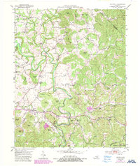
1952 Map of Shopville
USGS Topo · Published 1954About this map
Buck Creek carves a winding path through this corner of Pulaski and Rockcastle counties, defining a landscape marked by high ridges and family-named knobs. In the early 1950s, rural life centered around the scattered crossroads of Shopville, Elrod, and Vanhook, where local schools like Silver Star Sch and churches such as Sunnyside Ch served the upland communities. The map reveals a high density of family cemeteries, including the Childress Cem and Gilmore Cem, which provide a detailed record of the region's genealogical history. Terrain features like Custer Bluff and Cash Knob dominate the topography, while the southern reaches extend into the Cumberland National Forest. This period shows a complex network of hollows, such as Wildcat Hollow and Bolger Hollow, that funneled rural travel toward the creek bottoms before modern highway expansions altered the character of these isolated valleys.
Find a feature on this map
80 named features on this map. Tap any name to fly to it.
Don’t see what you’re looking for? This feature index may not catch every label — zoom into the map to look around manually.
Map Details
Editions of this 1952 Shopville Map
2 editions found
Other maps of this area

1893 · London
USGS Topo · 1:125,000

1897 · London
USGS Topo · 1:125,000

1935 · Somerset
USGS Topo · 1:62,500

1952 · Billows
USGS Topo · 1:24,000

1952 · Ano
USGS Topo · 1:24,000

1952 · Dykes
USGS Topo · 1:24,000

1952 · Woodstock
USGS Topo · 1:24,000

1953 · Maretburg
USGS Topo · 1:24,000

1953 · Mount Vernon
USGS Topo · 1:24,000
1954 · Bobtown
USGS Topo · 1:24,000