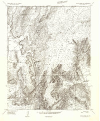
1956 Map of Short Creek NE
USGS Topo · Published 1956About this map
The Kaibab Indian Reservation dominates this mid-century landscape where the Kaibab Mountains meet the towering Vermilion Cliffs. The small settlement of Moccasin sits at the base of the cliffs, serving as a primary point of human activity in an area otherwise defined by extreme topographic relief and deep drainage systems like Parashont Canyon and Woodberry Canyon. Water management is the primary evidence of land use here, shown through various improvements such as Bee Cistern, Semen Cistern, and several family-named water sources like Woolley Spring and Burnt Corral Spring. A network of unimproved roads and a Jeep Trail trace the high ground, connecting remote landmarks like Ratashont Point and Lone Butte across the Arizona-Utah border.
Find a feature on this map
23 named features on this map. Tap any name to fly to it.
Don’t see what you’re looking for? This feature index may not catch every label — zoom into the map to look around manually.
Map Details
Editions of this 1956 Short Creek NE Map
This is the sole edition of this map. No revisions or reprints were ever made.
Other maps of this area

1886 · Kanab
USGS Topo · 1:250,000

1886 · Kaibab
USGS Topo · 1:250,000

1953 · Cedar City
USGS Topo · 1:250,000

1953 · Grand Canyon
USGS Topo · 1:250,000

1954 · Kanab SW
USGS Topo · 1:24,000
1954 · Short Creek SW
USGS Topo · 1:24,000

1954 · Fredonia NW
USGS Topo · 1:24,000

1954 · Short Creek SE
USGS Topo · 1:24,000
1954 · Short Creek NW
USGS Topo · 1:24,000

1954 · Fredonia SW
USGS Topo · 1:24,000