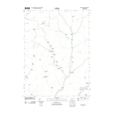
2010 Map of Short Run
USGS Topo · Published 2010About this map
Kettle Creek and Cross Fork carve through the deep drainage basins of this Potter County landscape, where the settlements of Short Run and Abbott represent the primary points of human habitation. The terrain is defined by a dense network of branching hollows and ridges, such as Hogback Hollow and Twin Sisters Hollows, which feed into the larger runs. Elevated vantage points like Horton Run Vista and Jamison Run Vista overlook the winding paths of Windfall Run and Little Lyman Run.
Find a feature on this map
71 named features on this map. Tap any name to fly to it.
Don’t see what you’re looking for? This feature index may not catch every label — zoom into the map to look around manually.
Map Details
Editions of this 2010 Short Run Map
This is the sole edition of this map. No revisions or reprints were ever made.
Other maps of this area

1943 · Hyner
USGS Topo · 1:62,500

1946 · Young Womans Creek
USGS Topo · 1:24,000

1946 · Renovo East
USGS Topo · 1:62,500

1946 · Renovo West
USGS Topo · 1:62,500

1946 · Hammersley Fork
USGS Topo · 1:24,000

1946 · Tamarack
USGS Topo · 1:24,000

1947 · Conrad
USGS Topo · 1:62,500

1947 · Galeton
USGS Topo · 1:62,500

1947 · Conrad
USGS Topo · 1:24,000

1947 · Short Run
USGS Topo · 1:24,000
Featured Places
- Abbott Township, PA
- Wharton Township, PA
- Stewardson Township, PA
- Gravel Lick, Stewardson Township
- Summit Township, PA