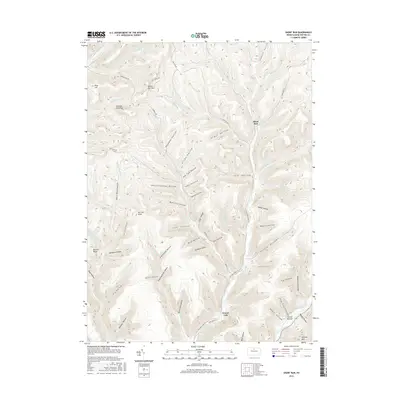
2016 Map of Short Run
USGS Topo · Published 2016About this map
Kettle Creek and Cross Fork carve through the deeply dissected landscape of Potter County, where narrow valleys and sharp ridges dictate the geography of the northern Pennsylvania highlands. This 2016 survey highlights a region defined more by its terrain and drainage systems than by large-scale development, with small settlements like Short Run and Gravel Lick anchored at the confluence of mountain streams. The map reveals an intricate network of named hollows, including Bachman Hollow, Knickerbocker Hollow, and Twin Sisters Hollows, which historically shaped local travel and hunting grounds. Scenic viewpoints such as Horton Run Vista and Jamison Run Vista offer perspective from the high ground near Pine Hill, while the lower elevations at Laurel Bottom mark the transition toward the larger creek basins. The presence of unpaved forest routes like Old Cross Fork Rd and Windfall Rd underscores the area's continued use for timber management and outdoor recreation.
Find a feature on this map
70 named features on this map. Tap any name to fly to it.
Don’t see what you’re looking for? This feature index may not catch every label — zoom into the map to look around manually.
Map Details
Editions of this 2016 Short Run Map
This is the sole edition of this map. No revisions or reprints were ever made.
Other maps of this area

1943 · Hyner
USGS Topo · 1:62,500

1946 · Young Womans Creek
USGS Topo · 1:24,000

1946 · Renovo East
USGS Topo · 1:62,500

1946 · Renovo West
USGS Topo · 1:62,500

1946 · Hammersley Fork
USGS Topo · 1:24,000

1946 · Tamarack
USGS Topo · 1:24,000

1947 · Conrad
USGS Topo · 1:62,500

1947 · Galeton
USGS Topo · 1:62,500

1947 · Conrad
USGS Topo · 1:24,000

1947 · Short Run
USGS Topo · 1:24,000
Featured Places
- Abbott Township, PA
- Wharton Township, PA
- Stewardson Township, PA
- Gravel Lick, Stewardson Township
- Summit Township, PA