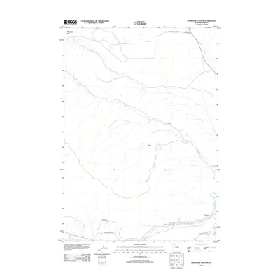
2012 Map of Shoshone Canyon
USGS Topo · Published 2012About this map
Shoshone Canyon and the surrounding high desert terrain dominate this 2012 survey of the landscape just west of Cody. The topography is defined by the carved path of the Shoshone River, which flows out of the Buffalo Bill Reservoir toward the thermal features of Needle Hot Springs and Shoshone Hot Springs. This area represents a critical intersection of natural hydrology and human engineering, where the Heart Mountain Canal diverts water to support the arid region's agricultural interests.
Find a feature on this map
20 named features on this map. Tap any name to fly to it.
Don’t see what you’re looking for? This feature index may not catch every label — zoom into the map to look around manually.
Map Details
Editions of this 2012 Shoshone Canyon Map
This is the sole edition of this map. No revisions or reprints were ever made.
Other maps of this area

1949 · Pat O'Hara Mountain
USGS Topo · 1:62,500

1949 · Cody
USGS Topo · 1:62,500

1951 · Cody
USGS Topo · 1:62,500

1955 · Cody
USGS Topo · 1:250,000

1957 · Wapiti
USGS Topo · 1:62,500

1957 · Devils Tooth
USGS Topo · 1:62,500

1958 · Cody
USGS Topo · 1:250,000

1962 · Cody
USGS Topo · 1:250,000

1980 · Carter Mountain
USGS Topo · 1:100,000

1980 · Cody
USGS Topo · 1:100,000